Autonomy Where GPS Ends
Modular active-sensor + autonomy stack for UAS navigation in GPS-denied, obstacle-rich environments.
Our Approach
Modular
Attach our sensor and autonomy package to existing UAS platforms, enhancing capabilities without replacing your current systems.
Fit-to-Purpose
Customizable configurations to meet specific mission requirements, from defense applications to environmental monitoring.
Scalable
From single-drone deployments to multi-unit fleets, our technology scales to meet operational demands across diverse environments.
Use Cases
Our technology enables autonomous navigation in challenging environments for both defense and environmental applications.
Carbon Quantification
Precise measurement of forest carbon stocks for climate markets and conservation initiatives.
Wildfire Fuel Mapping
Detailed mapping of vegetation density and structure to assess wildfire risk and plan mitigation strategies.
Forestry Planning
Under-canopy surveys for sustainable timber harvest planning and forest management.
The Glasswing™ Stack
Our integrated hardware and software solution enables autonomous navigation in GPS-denied, obstacle-rich environments.
Sensors
- •3-D LiDAR for long-range planning and mapping
- •High-resolution IR depth cameras for sub-centimeter obstacle detection
- •Inertial measurement units for position tracking
- •Modular design for mission-specific configurations
Perception & Control
- •Real-time sensor fusion algorithms
- •Simultaneous Localization and Mapping (SLAM)
- •Deep learning-based obstacle avoidance
- •Adaptive flight control systems
Mission Autonomy
- •High-level mission planning and execution
- •Autonomous route optimization
- •Adaptive behavior based on environmental conditions
- •Secure data collection and transmission
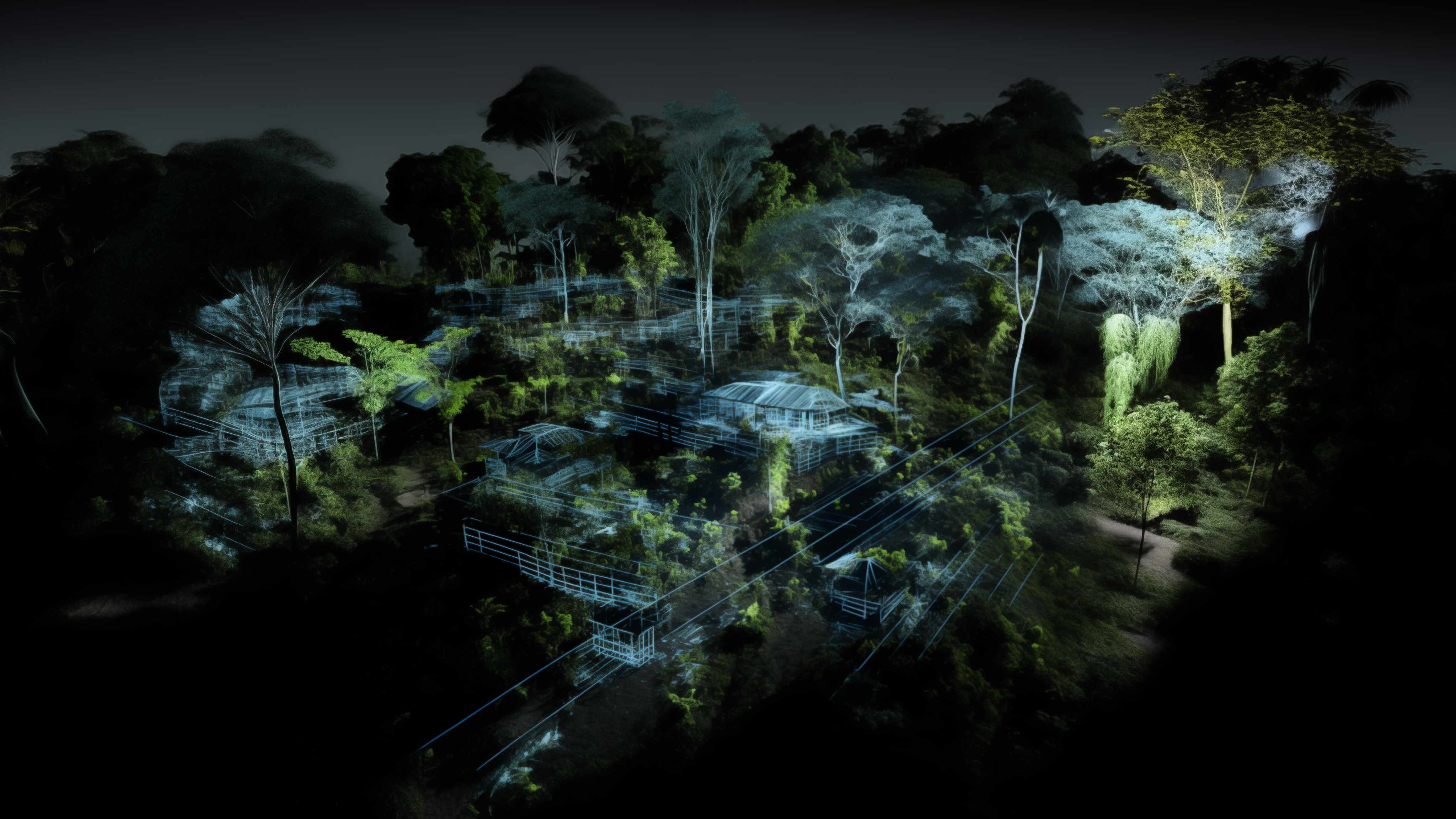
LiDAR mapping visualization of forest understory
Our Traction
Milestones and funding that are accelerating our development and deployment.
USDA NIFA Seed Award
Secured $300,000 funding for Project Clearwing to validate technology for precision forest carbon measurement.
Field Validation
Conducting field tests across nine-hectare plots in Arizona for fire-fuel mapping and timber-harvest planning.
DoD STTR Phase I
Pending approval for autonomous route-planning, personnel recovery, and encrypted under-canopy ISR for INDOPACOM and AFSOC.
Commercial Deployment
Planned rollout of Glasswing™ technology for commercial and defense applications.